Map - Alas (East Timor) (Alas)

Alas  (Alas)
Alas (East Timor) is a town in Alas Subdistrict. It is located in the interior of the island, 294 metres above sea level. As the crow flies, Alas is 56 km southeast of the state capital Dili und 7 km to the East of Same. Alas lies to the North of the Suco of Mahaquidan (Malaquidan, Malagidan), and the Alas suburbs of Uma Mean (Umanican, Umamean) and Beremanek are located in Mahaquidan. The suburbs of Lurin und Ailora are in the suco of Taitudac (Taitudak, Taitudac, Taitudal). It is located in the interior of the island, 294 metres above sea level. As the crow flies, Alas is 56 km southeast of the state capital Dili und 7 km to the East of Same. Alas lies to the North of the Suco of Mahaquidan (Malaquidan, Malagidan), and the Alas suburbs of Uma Mean (Umanican, Umamean) and Beremanek are located in Mahaquidan. The suburbs of Lurin und Ailora are in the suco of Taitudac (Taitudak, Taitudac, Taitudal). There is a medical station and a helicopter in Alas, as well as a primary school (Escola primaria Alas Vila) and a pre-secondary school.
 
Map - Alas  (Alas)
Map
Google - Map - Alas (East Timor)
Google
Google Earth - Map - Alas (East Timor)
Google Earth
Nokia - Map - Alas (East Timor)
Nokia
Openstreetmap - Map - Alas (East Timor)
Openstreetmap
Map - Alas  - Esri.WorldImagery
Esri.WorldImagery
Map - Alas  - Esri.WorldStreetMap
Esri.WorldStreetMap
Map - Alas  - OpenStreetMap.Mapnik
OpenStreetMap.Mapnik
Map - Alas  - OpenStreetMap.HOT
OpenStreetMap.HOT
Map - Alas  - CartoDB.Positron
CartoDB.Positron
Map - Alas  - CartoDB.Voyager
CartoDB.Voyager
Map - Alas  - OpenMapSurfer.Roads
OpenMapSurfer.Roads
Map - Alas  - Esri.WorldTopoMap
Esri.WorldTopoMap
Map - Alas  - Stamen.TonerLite
Stamen.TonerLite
Country - East_Timor
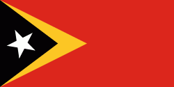
Flag of East Timor
East Timor, also known as Timor-Leste , officially the Democratic Republic of Timor-Leste, is a country in Southeast Asia. It comprises the eastern half of the island of Timor, of which the western half is administered by Indonesia, the exclave of Oecusse on the island's north-western half, and the minor islands of Atauro and Jaco. Australia is the country's southern neighbour, separated by the Timor Sea. The country's size is 14874 km2. Dili is its capital and largest city.

East Timor came under Portuguese influence in the sixteenth century, remaining a Portuguese colony until 1975. Internal conflict preceded a unilateral declaration of independence and an Indonesian invasion and annexation. Resistance continued throughout Indonesian rule, and in 1999 a United Nations–sponsored act of self-determination led to Indonesia relinquishing control of the territory. On 20 May 2002, as Timor-Leste, it became the first new sovereign state of the 21st century. That same year, relations with Indonesia were established and normalized, with Indonesia also supporting East Timor's accession into ASEAN.
Currency / Language  
ISO Currency Symbol Significant figures
USD United States dollar $ 2
Neighbourhood - Country  
  •  Indonesia